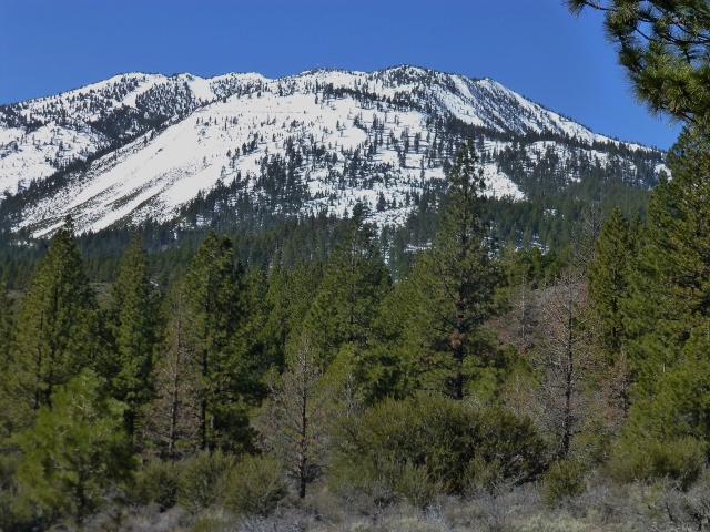

 Although there is still a lot of snow on the trails in the local Tahoe area, if you are getting anxious to start hiking, you can start putting in miles on dry dirt by going over to the eastern side of the Carson Range.
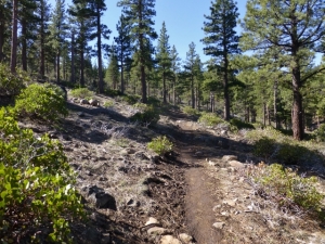
Last week, I took a 4.9 mile semi-loop on the Brown’s Creek Trail, a unit of the Washoe County Regional Parks and Open Space. This trailhead can be reached by going east over the Mt. Rose Highway (Rt. 431). After passing Galena Creek Regional Park you will soon reach Joy Lake Road. Turn right, and go 1.5 miles to the trailhead parking lot on the left side of the road. The trail begins directly across the street from the parking area.
The hike begins with a moderate uphill grade through Jeffrey Pines, Mountain Mahogany, bitterbrush, manzanita, and the ground-hugging mahala mat. In 1.2 miles you reach a short vista point path, and then once back on the trail in about 0.1 mile, you reach a 2,5 mile loop. Total elevation gain for this entire hike is about 1,000′.
Along the trail at this time of year you will most likely see Stellar’s Jays, Scrub Jays, Mountain Chickadees, Quail, and maybe a Northern Flicker. On the day I hiked, there was a small flock of Western Bluebirds migrating through. Wildflowers were just starting to bloom, including Spreading Phlox, Beckwith’s Violet, Moun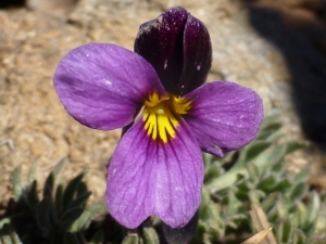 tain Violet, and Sand Corn.
Two other trails that are clear of snow on the east side of the Carson Range are the Hunter Creek Falls Trail, and the Steamboat Ditch Trail. You can search the internet for descriptions and directions to these trails.
Enjoy your hike, Tom